Lyne - Cloich Circular route
A really enjoyable half-day circular ride on grassy tracks, woodland paths and forest road to which you can add extra sections if you want to make it a bit longer.
For a direct link to access an online map for the route see the Peebles area page.
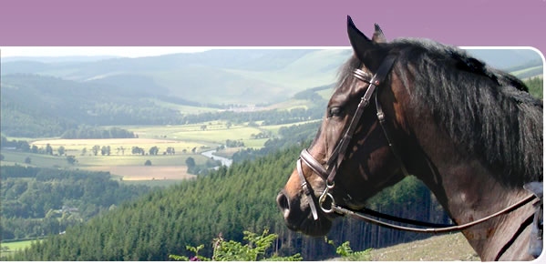
Location 3 miles north-west of Peebles in the Scottish Borders, just north of the Meldon Hills
Maps OS Landranger no. 73 (Peebles, Galashiels and surrounding area)
OS Explorer no. OL 337 (Peebles and Innerleithen)
Parking In the lay-by adjacent to the public toilets (be warned – they are usually closed in winter!) at OSGRNT213428, or if this is full, there is ample parking on firm ground just to the south of the toilet block on the minor road between Lyne and Eddleston (heading east along the A72, take first left immediately after the B712 turns off to Stobo. Road should be signed Lyne and Eddleston.)
Season Suitable all year, but please take care to avoid disturbing sheep at lambing time
Going Firm grass turf, stoned tracks and forest roads for most of the way with a short section on tarmac road but plenty of scope to vary the pace
Attractions
* Nearly all off-road
* Fantastic views
* Variety in scenery, pace, surface – what more could you ask?
* Half the route follows a historic post road
* Most of the gates are horse-friendly and can be negotiated without dismounting
Challenges None other than a very small burn which you can ford or jump
Services
Public toilets, petrol station, numerous cafes, food shops and supermarket in Peebles or Biggar. Pub/restaurant at Eddleston.
From the southern tip of the forest (former toilet block has now closed down), head north towards Eddleston on the minor road for approximately 50m, then before the cattle grid turn left at the fingerpost through the bridlegate, following the grass track up the bank back round to the left. At the top of the bank the track turns right (north again) through the trees, broadening out before it joins another wider track where the trees open out to a field. Turn right (north-north-east) at this T-junction, and around the side of the barrier if it is locked across the track to prevent illegal vehicular use. When you reach the tarmac access road to Harehope, continue straight over, through the bridlegate, heading roughly north on a good grass path. Ford the Harehope Burn, and continue straight ahead on the track, still heading roughly north, to the bridlegate at the north end of Harehope Forest. This is a great track for a canter, but make sure you can see clearly ahead in case you meet any dog walkers. Once through the bridlegate, continue north along the track between the parallel dykes with fields either side. Cross straight over the cross roads at Nether Stewarton, passing the cottage on your left as you climb gently uphill, enjoying the views around you. You are now on the old drove road which was once the main route south for cattle heading from the Highlands to market in Smithfield, London. Shortly after the stone interpretive cairn which tells you more about the history of the old drove road, go straight through the gate ahead across the track into a large grass field. Continue north, parallel to the dyke on your right, through another three gates, to Muir Plantation (OSGRNT228472).
The main circular route carries straight on NNE along the track ahead, over the culverted burn, and through another gate which leads you back into grass fields. Stone from the dyke which once ran alongside the west side of the track has been used to rebuild the remaining dyke on the east side of the track. Go straight through the next gate across the track adjacent to the cattle grid, and continue straight ahead still heading NNE on the main stoned track, through a bridlegate adjacent to the next cattlegrid/gate, to join the public road at Shiplaw.
Variation: For a slightly longer ride, fork off to the right (east) at Muir Plantation,
or at the cattlegrid at the corner of Swiss Cabin Wood (both have good grassy waymarked tracks) down past Barony Castle into Eddleston. The Horseshoe pub does food but nowhere to leave horses. Turn left (north) on the A703 for approx 200m, then cross over onto the Old Edinburgh Road which runs parallel and to the east of the main road, past the café, until you reach the safe horse crossing across the main road to Darnhall just south of Harcus. Immediately after passing Darnhall farmhouse on the right, turn right through the steading, and then follow the left branch in the track which circles west around the north side of the wood to rejoin the main route just north of Hare Laws, where you turn right to Shiplaw.
At Shiplaw turn west on the minor road past the old observatory until you reach the edge of Cloich Forest. Turn left (south) on the main forest road, past Cloich Farm. Continue on this forest road until you reach the Y-junction just before Greenside/Courhope, with an open field on your right, where you branch left and immediately left again on the waymarked track which climbs east up through the forest and then leads back down along the line of the old drove road through a gate in the forest boundary fence, to Upper Stewarton. Head east across the field to the gate between the house and barn, from a firm track continues east, rejoining the old post road opposite the interpretive cairn. Turn right at the t-junction, heading south, past Nether Stewarton and retrace your steps back down to Lyne. Alternatively if you don’t want to retrace your steps on the original off-road track back to Lyne, you can follow the main access road from Nether Stewarton east to the minor Eddleston-Lyne road and then ride down the very quiet public road. You can also access this road off the main drove road through the gate onto the car park due north of Harehope Burn, or along the Harehope access road.
Other variations
You can add an extra loop at the southern end of the route by following the woodland track between Green Knowe and Harehope.