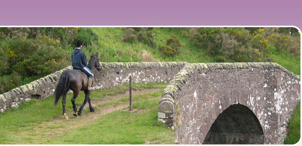
Hawick Riding Route
The 27 mile circular Hawick Riding Route was the first dedicated riding route to be developed in Scotland. The majority of the route is off-road, following farm tracks and former drove roads through the heart of the Scottish Borders. As the name of the route implies, the route circles around the small town of Hawick, so you are never too far from civilisation, but much of the time feel as though you are miles from anywhere. This route is now included within the Buccleuch Country Rides, for which a full information pack is avaliable from Visit Scotland or Tourist Information Centres. A route description is also provided below to help you enjoy this route.
The directions are written in a clockwise direction but the route is equally enjoyable anti-clockwise. Because the route is circular and intersected by various roads and tracks, it is relatively easy to devise a shorter ride for yourself if you don’t have enough time for the whole route, hit bad weather or lose a shoe.
Services and accommodation
The three Horses Welcome accredited horse and rider accommodation providers at Wiltonburn Farm west of Hawick, Cavers Garden Farm south-east of Hawick and East Boonraw are ideally placed to split the ride over two days, allowing ample time to enjoy the views and make the most of the spectacular riding.
Hawick offers a wide variety of shops, supermarkets, cafes, pubs, restaurants and take-aways as well as petrol stations.
Parking
Parking is available by prior negotiation at Wiltonburn, East Boonraw or Cavers Garden Farm. Alternatively there are various public lay-bys, such as on the A7 at Groundistone Height north of Hawick directly on the route, where there is nearly always ample space to park a trailer or horsebox, but please note all parking is at your own risk.
Linking routes
The Buccleuch Rides include a linear link to the circular routes around Bowhill and Ettrickbridge, from where you can link through to Yarrowford to pick up the SOSCT Minch Moor section of the Cross Borders Drove Road, which links into other SOSCT routes in the Tweed Valley around Innerleithen and Peebles.
Scottish Borders Council are still developing the link east from Hawick to the Jedburgh circular riding route. For further information contact their access team on 01835 826509. In the meantime, you can make your own link following quiet lanes and off-road farm tracks.
Wiltonburn – A7
Heading east from Wiltonburn on the minor public road, after approximately 0.4km a clearly defined track is signed branching off to the north (i.e. left). Climb up this old drove road between the twin dykes which cattle were once driven through. At the t-junction with the public road, turn left (north-west) and follow the quiet road around the bends past Whitehaugh for approximately 2km. Follow the road around the corner of a wood on your right, ignoring the track off to your left to Calaburn and Whitfield. At the apex of the wood, where the road turns sharp right, bear left (north) following the waymarked track round to the right and then left. Follow the track north-west between the twin dykes of the old drove road, through a few gates, ignoring the track of to your right to Whitehaughmoor. At the end of the shelterbelts on your left, the track leads through another gate onto the open moor. Continue in the same direction as the track, uphill on a grassy track. At the top of the ridge, turn right (east) through a waymarked gate. The grass track is clearly defined and will lead you on, through another gate, past a recently replanted wood on your right at Outer Grey Hill, to the trig point on Drinkstone Hill. Carrying on along the ridge, 50m beyond the trip point, a gate leads between two shelterbelts, and through a field with the fence on your left, to the junction with the old drove road. If there is a bull in the field, give it a wide berth!
Ignore the field gate on your left, and turn left (north) through the waymarked bridlegate immediately beyond. Keeping the fence and water trough on your left, follow the grassy track up to the waymark post at the next ridge. The track is less clearly defined here, with the main drove road continuing north to link with the Buccleuch Rides, but you can clearly see a gap between two stands of trees to the north-east where there is a track between the woods of Groundistone Covert.
Go through the bridlegate in the dyke on your left at the northern end of this gap, and immediately turn right, following alongside the dyke, through a further gate in the next fenceline, continuing north-east parallel to the dyke on your right. Take your time as the ground here can be damp in places but is firm underneath.
Shortly before the A7, turn right (south) through the waymarked bridlegate in the dyke. Follow the grass track parallel to and west of the A7 south, through another gate, to the bridlegate in the dyke opposite the Muirfield farm track.
Note: If the gate in the dyke is not passable, carry straight on through the main field gate to exit onto the A7. Traffic can be fast and heavy but there is a good wide verge alongside heading south towards the Muirfield farm road end.
A7 – Clarilaw - Appletreehall
The farm track to Muirfield turns off the A7 about 2-3 miles north of Hawick perhaps 20 metres north of the bridlegate on the west side of the road. The farm track itself is unsigned but is easy to find at the southern end of a shelterbelt on the east side of the A7. The gate next to the cattle grid half way down the track looks worse than it is, and you may well manage it without dismounting. Pass the farmhouse on your left, and then immediately past the two new barns on your left, turn right heading south-east down an enclosed drove road. On your left (east) between the two gates across the northern end of the drove road you will see the fenced enclosure of a former reservoir. The old drove road is clearly marked on the map and easy to navigate between the parallel fences/dykes, but is boggy in places. (Scottish Borders Council are considering alternatives, for example the route which local riders appear to be using through the forestry to the west of the drove road, which rejoins the drove road at the southern end of the forest). There is a convenient bank to remount if you have had to dismount to negotiate the third gate beyond the end of the forest, beyond which the track becomes firm and grassy underfoot, tree-lined for much of the way.
Shortly after the track bends right (west), just before you reach a wood on your right, you will reach a clear junction, where the Hawick Riding Route should be waymarked down the track to your left, heading south-east towards Clarilaw rather than continuing along the main track towards Newhouses. The gate at the junction is often open, and if not, the first section of fence may have been removed.
The drove road joins the B6359 at Clarilaw. Continue straight ahead (south-east) for a few hundred metres, keeping on this same road around a right-angled bend to the right, to Appletreehall. This road is usually quiet but keep to the side to avoid blocking the road. While you are admiring the lovely views, look out for the old fort on the side of Clarilaw Hill to your left (south).
Appletreehall – Cavers
At the cross-roads at Appletreehall, turn left (south-east), following the minor road past Courthill, over the disused railway line to a t-junction. Turn right (south-west) along the road towards Hawick, which runs parallel to the disused railway. Just after the 30mph speed limit sign and immediately before a housing development, follow the fingerpost which directs you left (south-east) down a wooded track, passing cottages on your left, with a burn on your right. When you reach the end of this track just before the burn joins the River Teviot, turn right over a small concrete bridge, 50m across the grassy public area, to the ford across the Teviot. The ford is not signed, but is easily identifiable by the clearly defined exit on the opposite bank upstream of the cottages. After crossing the ford, follow the track around the back of the cottages, through a gate, to the A698. Cross the road with care, and then turn right (west) and immediately left up the A6088 signed towards Cavers and Bonchester Bridge.
Like so many other rivers in the Borders, the River Teviot is quite flashy, which means that the water level goes up and down fairly quickly after heavy rain. If the Teviot is in spate or you are in any doubt about fording the river, retrace your steps to where you left the road alongside the disused railway, turn right and then take the first road to the right to cross the river at Hornshole Bridge. Turn right on the A698 towards Hawick, to rejoin the main route where you branch up the A6088.
Follow the A6088 south, climbing up the hill, past Beechhurst on your right. Watch out for motorbikes using this road at the weekend. After 1km, at Woodburn, turn sharp left (east) following the road signed to Cavers. Shortly after the new stables at Kinninghall, you will pass Cavers Church on your left, with its distinctive architecture. Turn right up the pleasant track opposite the church, which climbs alongside a wood.
The double gates at the top of the hill lead through to Townhead of Cavers where Cicely Thorne offers superb accommodation for horse and rider.
For those not staying overnight at Townhead of Cavers, carry along the main track without turning through the gates until you reach a cross-roads. Turn left (north-east) and follow this road to the next cross roads. Please keep to the hard track rather than riding along the neatly mown verges.
Cavers – Kirkton
Where the track meets the public road at the next cross roads, with a cottage on your right, turn right (south) along a clearly waymarked firm track, which leads down through a wood and on to Cavers Knowes through a series of newly replaced self-closing gates which are easy to negotiate without dismounting. Follow the clearly defined and well waymarked firm track south-west, along the side of several fields and through several more self-closing gates,to re-join the A6088 at Kirkton.
Kirkton – Branxholm
Ride south along the A6088 through Kirkton, heading towards Bonchester Bridge. Just south of the village, the Hawick Riding Route is clearly signed along the old drove road which branches off to the right (west). The ford through the shallow burn shortly after you leave the public road is a safer option than the bridge which can be slippery, particularly when wet, and there is no guarantee as to how sound the sleepers are.
Follow the old drove road as it climbs up the hill, continuing south-west along the main track keeping the dyke on your right. West of Kirkton Hill, ignore the mown grass gallop which turns off through a gateway on your right after the barn. Instead carry straight on through the gate, alongside a wood on your left, to the last gate onto the open hill. The route should be clearly waymarked and the new self-closing gates will confirm you are on the right route if you are in any doubt.
Beyond the gate the track becomes grassy as it climbs gently up to the old steading at Adderston Lee in exactly the same south-westerly direction as you were previously headed. 100m beyond Adderston Lee, turn right off the old drove road. Look out for the waymark posts which will confirm you are heading due west, at 45 degrees to the contour across the north face of the hill, continuing down to a gate which leads through a shallow ford over the Horseley Burn. Continue north on the track climbing up out of the ford, with a wall on your right (east), ignoring tractor and quad tracks off to either side until you have passed through two gates, both of which have waymark disks to confirm you are on the Hawick Riding Route. After the second gate at OSGRNT517118, the track turns sharp left (west) to another gate. Turn right down the Coliforthill farm track, and follow this down to join the B6399 just beyond the bridge over the Slitrig Water at Whitelawhaugh.
Turn right (north) towards Hawick on the B6399. After half a mile, turn left (west) at Hummelknowehaugh along the minor road which leads over the disused railway, up past Flex Farm to the race course. The route is waymarked off the B6399 but the post may be obscured by the hedge. The marker posts confirming that you should continue straight on (south-west) at Williestruther Cottage, passing the loch on your left, and then turn right (north, heading towards Hawick again) at the t-junction should be clearly evident.
After 0.4km, turn left through the open gates to St. Leonard’s Park racecourse. Follow the road around the north of the racecourse until you see a waymark post at the end of the metalled road which directs you off to the right (north) through a gate in the stone dyke onto the moor. Ride straight on, past the marker post on your right, around the contour of the hill, heading north-west to a newly installed wooden bridlegate in the dyke on the far side of this field. Once through the gate, the route is clearly waymarked along the west side of the next field, parallel to the fence on your left, leading to another new bridlegate on your left just before the trees, which leads onto the public road. Turn right (north) down the road to the t-junction at Haysike, where you turn left left (west), down the hill to the A7 at Branxholm.
Branxholm – Wiltonburn
From the junction of the minor road from Haysike, turn sharp left on the A7, over the bridge across the River Teviot, and then sharp right along the waymarked track which runs parallel to and west of the river to a ford across the Borthwick Water, 100m beyond which the track leads onto the B711 Hawick-Roberton road.
After heavy rain, or if you are worried about fording the Borthwick Water, turn right on the A7 towards Hawick and then first left over Martin’s Bridge at the sign to Wiltonburn to rejoin the main route north of the ford. Take care on the A7.
Head west on the A711 towards Roberton for approximately one mile, and then right at the cottages up the waymarked track which skirts around the west side of Borthaugh Hill to the top of the rise. Follow the track as it bears right (east) around the northern base of the hill. After 600m turn left through the gate, across the edge of the field, through another gate and then turn right down a farm track to Wiltonburn.